Places
Hiking Yosemite: The Best Day Hikes, from Easy Valley Walks to Half Dome
Hiking is the best way to understand Yosemite’s scale. From the Valley floor the cliffs look close; climb a thousand feet up a switchback trail and you begin to see how far they really rise. The park counts over 800 miles of trails on its hiking safety page (its things-to-do page says over 750), and nearly 95 percent of Yosemite is designated Wilderness. Most visitors, though, choose from a short list of day hikes in and above Yosemite Valley, plus a handful off the Glacier Point and Tioga roads in summer.
This guide sorts those hikes by effort, using the National Park Service’s own distances, elevation gains and times. A note on the numbers: the park’s pages occasionally disagree with each other, and where they do, both figures are given.
Yosemite Valley day hikes at a glance
| Hike | Difficulty | Distance | Climb | Time |
|---|---|---|---|---|
| Bridalveil Fall | Easy | 0.5 mi round trip | 80 ft | 20 minutes |
| Lower Yosemite Fall | Easy | 1 mi loop | 50 ft | 30 minutes |
| Cook’s Meadow Loop | Easy | 1 mi loop | Flat | 30 minutes |
| Mirror Lake | Easy to moderate | 2 mi round trip (5 mi loop) | 100 ft | 1 hour (2-3 hours loop) |
| Valley Loop Trail | Moderate | 7.2 mi half loop, 11.5 mi full loop | Mostly level | 2.5-3.5 hours / 5-7 hours |
| Vernal Fall Footbridge | Moderate | 1.6 mi round trip | 400 ft | 1-1.5 hours |
| Top of Vernal Fall (Mist Trail) | Strenuous | 2.4 mi round trip | 1,000 ft | 3 hours |
| Columbia Rock | Moderate | 2 mi round trip | 1,000 ft | 2-3 hours |
| Top of Nevada Fall (Mist Trail) | Strenuous | 5.4 mi round trip | 2,000 ft | 5-6 hours |
| Top of Yosemite Falls | Strenuous | 7.2 mi round trip | 2,700 ft | 6-8 hours |
| Snow Creek Trail | Strenuous | 9.4 mi round trip | 2,700 ft | 6-7 hours |
| Four Mile Trail to Glacier Point | Strenuous | 4.8 mi one way | 3,200 ft | 3-4 hours one way |
| Half Dome | Strenuous | 14-16 mi round trip | 4,800 ft | 10-12 hours |
Every hike in this table except Bridalveil Fall starts at or near a stop on the free Valley shuttle, so you can leave the car where you parked it. That matters: the park advises day visitors to arrive before 9 am, after which Valley parking is usually full.
Easy walks to the waterfalls
Lower Yosemite Fall is the walk to do if you only have an hour. The paved 1-mile loop starts at shuttle stop #6, climbs about 50 feet and takes around 30 minutes. It ends at a footbridge under the lower fall, the final 320-foot drop of Yosemite Falls, and in spring and early summer you will get sprayed. The park suggests walking it clockwise for the best views of both the upper and lower falls; the eastern half is wheelchair accessible. The catch is timing: the fall is often dry from late July or August through October.
Bridalveil Fall is usually the first waterfall people see on the drive in, and the shortest walk: 0.5 miles round trip, about 80 feet of climb, 20 minutes, from its own parking area. The fall plunges 620 feet and flows year-round, thundering in spring and swaying in the wind the rest of the year. There is no shuttle to this trailhead.
Cook’s Meadow Loop is the flat 1-mile, 30-minute circuit from the Yosemite Valley Visitor Center (shuttle stop #5) through the meadow in the middle of the Valley. It has some of the classic views: Yosemite Falls, Half Dome, Glacier Point and Sentinel Rock, plus a stop on Sentinel Bridge for Half Dome reflected in the Merced River.
Mirror Lake starts at shuttle stop #17. The first mile is a paved service road straight to the lake, 2 miles round trip and about an hour. A 5-mile loop continues up Tenaya Creek and back, taking 2-3 hours. Go in spring or early summer: the lake has little water much of the year, and the park says it is often called Mirror Meadow by late summer.
The Valley Loop Trail
For a long, nearly level day, the Valley Loop Trail follows many of the Valley’s first east-west trails and wagon roads past El Capitan, Bridalveil Fall, Cathedral Rocks and the Three Brothers. The trail’s own page gives 7.2 miles for the half loop (2.5-3.5 hours) and 11.5 miles for the full loop (5-7 hours); the park’s Valley hikes table lists 6.5 and 13 miles. Either way, it is the place to find some solitude on the Valley floor. Bring water, because there is none along the way. One temporary snag: the trail over El Capitan Bridge, which links the north and south halves, is closed on weekdays through December 2026 for bridge work.
The Mist Trail to Vernal Fall and Nevada Fall
This is the most popular hike in Yosemite, and for good reason. It starts at Happy Isles (shuttle stop #16) and climbs beside the Merced River to two big waterfalls.
- Vernal Fall Footbridge: 1.6 miles round trip, 400 feet of climb, 1-1.5 hours. The footbridge, at 0.8 miles, has an excellent view of Vernal Fall, and the paved first mile is the busiest part of the trail.
- Top of Vernal Fall: 2.4 miles round trip, 1,000 feet, about 3 hours. Beyond the junction the Mist Trail climbs 0.3 miles up a granite stairway of over 600 steps, soaked by spray in spring and early summer. At the top you look straight down the 317-foot fall.
- Top of Nevada Fall: 5.4 miles round trip, 2,000 feet, 5-6 hours, past Emerald Pool and the Silver Apron and up steep, rocky switchbacks beside the 594-foot fall.
You can return by the John Muir Trail, which the park puts at about 4 miles one way against the Mist Trail’s 2.5 miles: longer, but gentler on the knees, with views of Liberty Cap and Nevada Fall. Many hikers make a loop, up the Mist Trail and down the John Muir Trail.
Things to know:
- Do not swim in Emerald Pool or on the Silver Apron above Vernal Fall. The park says it is illegal and dangerous because of the current.
- Water: carry 1 quart to the footbridge, 2 to the top of Vernal Fall and 3-4 to the top of Nevada Fall. In season there is drinking water at the footbridge, but not above it.
- Winter: the lower Mist Trail along Vernal Fall closes for falling ice and rock, and the John Muir Trail between Clark Point and the top of Nevada Fall closes for ice. A winter route stays open.
Rockfall is part of the Valley’s life. On March 31, 2025, at 9:30 pm, about 150 cubic meters of rock fell from Grizzly Peak onto the Mist Trail near the Vernal Fall footbridge, and that stretch closed for several weeks while crews cleared it.
The Yosemite Falls Trail
One of Yosemite’s oldest historic trails, built from 1873 to 1877, climbs from the Camp 4 area (near shuttle stop #7) to the top of the falls, which drop 2,425 feet in all. It starts climbing at once, switchback after switchback.
- Columbia Rock: 2 miles round trip, 1,000 feet, 2-3 hours, with wide views over the Valley, Half Dome and Sentinel Rock. Another 0.5 miles brings you to a close view of Upper Yosemite Fall.
- Top of Yosemite Falls: 7.2 miles round trip, 2,700 feet, 6-8 hours. The upper half is steep and rocky. From the top you can add Yosemite Point (1.6 miles round trip) or Eagle Peak (5.8 miles round trip), the highest point on the Valley’s north rim.
The trail is open all year, but it changes with the seasons. In spring you may be wet with spray; in summer it is hot and exposed, and the park advises starting early because it can become very hot at midday; by August the fall may be only a trickle. In winter the lower trail gets sun and can be snow-free, while the shaded upper part can be icy or buried. There is no water on the trail: the park says to bring 4 quarts to the top.
Four Mile Trail and Snow Creek
The Four Mile Trail climbs from Southside Drive (shuttle stop #11) to Glacier Point: 4.8 miles one way, 3,200 feet of climb, 3-4 hours up, or 9.6 miles round trip. It follows an old toll trail completed in 1872, and the park admits it is now closer to five miles than four. The views of El Capitan and Yosemite Falls build steadily, and the side trip to Union Point is worth it. The trail usually opens sometime in May; after heavy snow only the lower three miles stay open, to a gate below Union Point. There is no free shuttle between Glacier Point and the Valley, so plan to hike back or arrange a ride.
The Snow Creek Trail is the quiet alternative: 9.4 miles round trip, 2,700 feet, 6-7 hours, from the Mirror Lake trailhead (shuttle stop #17). It climbs dozens of switchbacks out of Tenaya Canyon with views of Half Dome and Clouds Rest, and the park notes you will often find fewer people than on other Valley trails.
Half Dome: the hike and the permit
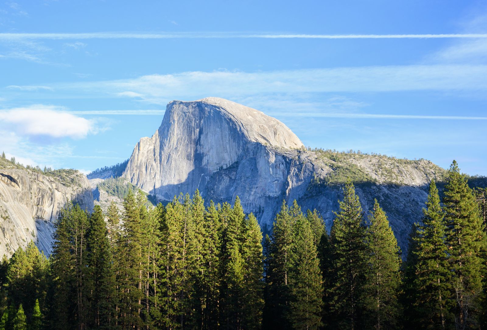
Half Dome rises nearly 5,000 feet above Yosemite Valley to 8,800 feet above sea level. An 1865 report declared it perfectly inaccessible; George Anderson reached the summit in 1875. Today, thousands do.
The hike. It is 14 to 16 miles round trip with 4,800 feet of climb, mostly via the Mist Trail or John Muir Trail, Little Yosemite Valley and the subdome. Most hikers take 10 to 12 hours. The last 400 feet go up two metal cables. The park’s advice is blunt: leave around sunrise, carry a headlamp, and set a non-negotiable turnaround time; its example is turning back if you have not reached the top by 3:30 pm. Carry at least 1 gallon of water. The summit is typically 15°F to 20°F cooler than the Valley, and it is a dangerous place in a lightning storm: in July 1985, lightning there killed two people and injured three others. Nearly all fatal falls from the cables have happened when the rock was wet.
The season. The cables are normally up from the Friday before Memorial Day until the day after the second Monday in October. A permit is required every day the cables are up.
The permit. A maximum of 300 hikers a day are allowed beyond the base of the subdome, about 225 day hikers and 75 backpackers. Day-hiker permits go by lottery on Recreation.gov:
- Preseason lottery: applications from March 1 through March 31, results in mid-April, up to six permits per application, 225 permits for each day.
- Daily lottery: applications two days before the hike, from midnight to 4 pm Pacific time, for permits left by cancellations and under-use.
- Fees: a non-refundable $10 per application, plus $10 per person when you win.
Rangers check permits at the base of the subdome, and the permit holder or the named alternate must be with the group. The permit only covers the trail beyond the base of the subdome, so without one you can still hike the Mist Trail to the top of Nevada Fall and turn back there.
Trails off the Glacier Point Road
When the Glacier Point Road is open, usually from May to November, it gives access to some of the best short hikes in the park, starting high so the climbing is modest.
- Glacier Point overlook: a 300-yard paved stroll, 10-15 minutes, to a rail 3,200 feet above the Valley.
- Sentinel Dome: 2 miles round trip, 400 feet, 1-2 hours, ending with a scramble up the granite for 360-degree views.
- Taft Point: 2.2 miles round trip, 200 feet on the return, 1-2 hours, to the rim of the Valley with views of El Capitan and Yosemite Falls.
- McGurk Meadow: 1.6 miles round trip, 150 feet on the return, 1-1.5 hours; best in early summer for wildflowers.
- Dewey Point: 7.6 miles round trip, 750 feet, 4-5 hours, through meadow to the Valley rim.
- Panorama Trail: 8.2 miles one way from Glacier Point, 6-8 hours, dropping to Illilouette Fall and climbing 800 feet before descending past Nevada and Vernal Falls to the Valley. (The Four Mile Trail page puts the Panorama Trail at 8.5 miles to Happy Isles.)
- Pohono Trail: 12.5 miles one way along the whole south rim from Glacier Point to Tunnel View, 8-10 hours.
Tuolumne Meadows and the Tioga Road
The high country opens when the Tioga Road does, typically from May or June to November. Trails start around 8,600 feet, so even short climbs feel harder; services are very limited, so bring all your food and water.
- Pothole Dome: 1 mile round trip, 200 feet, a short scramble for meadow views.
- Parsons Lodge and Soda Springs: 1.4 miles round trip, mostly flat, to cold bubbling springs and the historic lodge.
- Gaylor Lakes: 2.6 miles round trip, a short but steep 500 feet from the Tioga Pass Entrance, 2-3 hours.
- Dog Lake and Lembert Dome: 3.8 miles round trip, 850 feet, 3-4 hours.
- Elizabeth Lake: 6.8 miles round trip, 1,000 feet, 6-7 hours.
- Cathedral Lakes: 7.6 miles round trip, 1,000 feet, 6-7 hours; the park calls it the area’s most popular trail.
- Glen Aulin: 11 miles round trip, 6-8 hours, following the Tuolumne River 5.5 miles down; continuing to Waterwheel Falls makes it 19 miles in all.
Wawona, the Mariposa Grove and Hetch Hetchy
Wawona is near the South Entrance, about an hour’s drive from Yosemite Valley. The 3.5-mile Wawona Meadow Loop is mostly flat (2-3 hours) and is the only hiking trail in Yosemite where bicycles and leashed pets are allowed. Chilnualna Falls is the hard one: 8.2 miles round trip and 2,400 feet of climb, 5-7 hours, to the top of a fall you can only see by hiking it.
The Mariposa Grove has gentler options among the giant sequoias: the 0.3-mile Big Trees Loop (30-45 minutes, wheelchair accessible), the 2-mile Grizzly Giant Loop (1.5-2 hours, 300 feet) and the 6.5-mile Guardians Loop (4-6 hours). The trail up to Wawona Point gains 1,200 feet; the grove page gives it as 7 miles round trip, the Wawona hikes page as 7.75. Our list of things to do in Yosemite covers how the grove shuttle works.
Hetch Hetchy, at 3,900 feet, has one of the longest hiking seasons in the park. The Wapama Falls trail runs 5 miles round trip along the reservoir with 507 feet of up and down, past Tueeulala Falls to the footbridges below Wapama. Lookout Point is 2 miles round trip with 680 feet of climb from the entrance station, and Rancheria Falls is 13 miles round trip, as a long day hike or an overnight. Swimming and boating in the reservoir are prohibited.
Staying safe on Yosemite’s trails
Rangers and search and rescue respond to approximately 250 emergency incidents in the park each year, most involving injured or lost hikers. The park’s basics:
- Carry water: a minimum of 1 quart every 2 hours, and more on the big climbs. Most Valley trails have no water above the trailhead.
- Carry a headlamp, even on short hikes. Hikers commonly get caught by darkness on the way down.
- Start early in summer, when the exposed trails bake by midday and storms build in the afternoon.
- Stay on the trail. Off-trail rocks by the waterfalls are slippery even when dry, and cutting switchbacks causes erosion and injuries.
- Bears: keep food within arm’s reach on the trail; stay at least 50 yards away from a bear in the forest, but yell to scare off one that approaches you. Improper food storage can bring a fine of up to $5,000.
- Lightning: reach summits early and get off domes when clouds build.
Which hike, which season?
Spring (April to June) is for the waterfall trails: the Mist Trail, Lower Yosemite Fall, Bridalveil Fall and Wapama Falls, with spray and crowds. Summer (July to September) opens the high country, the Glacier Point Road and Half Dome. Fall brings quiet trails but low falls, and winter leaves the Valley floor and the sunny lower Yosemite Falls Trail, with many upper trails icy or partly closed.
Our Yosemite weather guide has the monthly averages and road calendar behind these choices. If you would rather walk with a guide and leave the driving to someone else, see our comparison of Yosemite tours; for entry and reservation questions, read our guide to entrance fees and reservations.
Frequently asked questions
What is the best easy hike in Yosemite?
The Lower Yosemite Fall loop: 1 mile, about 50 feet of climb and 30 minutes, ending under the final 320-foot drop of Yosemite Falls. Go in spring or early summer; the fall is often dry from late July or August through October.
How long is the Mist Trail?
To the top of Vernal Fall it is 2.4 miles round trip with 1,000 feet of climb, about 3 hours. To the top of Nevada Fall it is 5.4 miles round trip with 2,000 feet, 5-6 hours. Both start at Happy Isles, shuttle stop #16.
Do I need a permit to hike Half Dome?
Yes, every day the cables are up, normally from the Friday before Memorial Day to the day after the second Monday in October. Day-hiker permits are awarded by a preseason lottery in March and daily lotteries two days ahead, for $10 per application plus $10 per person.
How hard is the Yosemite Falls Trail?
Strenuous: 7.2 miles round trip with 2,700 feet of climb, 6-8 hours, on steep and rocky switchbacks with no water. For a shorter outing, Columbia Rock is 2 miles round trip with 1,000 feet of climb.